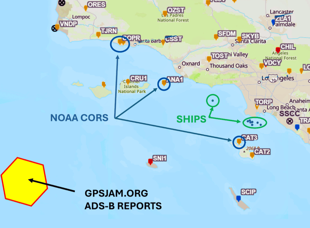
On the night of January 29, 2026, seven ships navigating towards the Port of Long Beach encountered severe GPS interference. This disruption caused vessels to lose their Automatic Identification System (AIS) data, electronic chart system functionality, and the ability to communicate via VHF radio. The incident forced masters to rely on traditional navigation methods and manual communication, underscoring the critical dependence of modern maritime operations on satellite-based systems.
This event serves as a stark reminder of the potential for widespread disruption if such interference were to occur in more congested or critical waterways. For freight forwarders and operations managers, this type of incident can lead to significant delays, increased safety risks, and potential re-routing challenges. Loss of AIS data also impacts supply chain visibility, making it harder to track vessel positions and estimated times of arrival. Forwarders should consider the implications for schedule reliability and potential cargo insurance claims in such scenarios.
The incident emphasizes the urgent need for the maritime industry to develop and implement more robust, resilient navigation and timing systems that are less susceptible to GPS jamming or spoofing. While the exact cause of the interference was not specified, the event highlights a vulnerability that could be exploited, intentionally or unintentionally, impacting global trade flows.